Hike #1616
Trail Canyon Trail
June 11, 2025
Hike Leader: Steve Babcock
Meet at 8:00 am for start at 8:30 am
Rabbits start at an earlier time to be determined
Please print your own hike descriptions and maps.
Directions to the Trailhead: From the 210 freeway take the Sunland exit and go East on Foothill Blvd. Go approx. 1.6 miles east on Foothill and turn left on Mt. Gleason Blvd. NOTE: There are no restroom facilities at the trailhead. There is a Mc Donalds on the right shortly before we turn on Mt. Gleason Blvd. Go north on Mt. Gleason approx. 1.1 mi. (the last 0.1 mile is a jog to the left) and turn right on Big Tujunga Canyon Road. You then drive approx. 3.4 mi. to where there is a dirt turnoff on the lefthand (north) side. It is at milepost 2.04. It isn’t really marked well so be watchful. Park here along the highway.
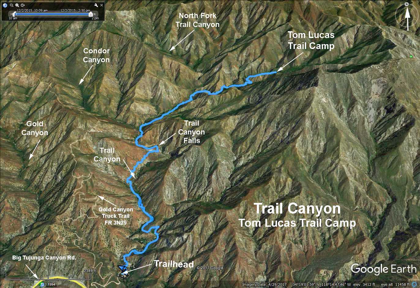
The Hike: We walk past the gate and follow a dirt road to the trailhead near some cabins. After about 1 mi. you leave the road and start on the trail. You encounter several shallow stream crossings, so hiking sticks are recommended. Eventually you leave the creek bed to climb over the Trail Canyon Falls. Scrambling down the steep slippery slope to the pool can be accomplished, but it is only for the most adventurous among us. The trail now drops into the canyon to continue our hike to the Trail Camp. Reports say the trail from here is overgrown but passable. Be sure to wear long pants if you want to try it.
Return the way you came.
After the hike we should all drive one short mile further up the highway to the Wildwood Picnic Site, where we will have shaded tables and restrooms for our after-hike gathering. Be sure to bring a federal parking pass! https://angelesnf.stqry.app/story/254157
GPS Data:
Trail Canyon Falls - 4.5 miles round trip, 900 ft elevation gain
Tom Lucas Trail Camp - 8.6 miles round trip, 2000 ft elevation gain
Google Earth - Tom Lucas Trail Camp
HikeSpeak - Trail Canyon Falls
Updated: 2025-06-07